Seden Strand
In the inner part of Odense fjord (DK), 8 km from Odense city center, lies the managed realignment area of Seden Strand. The area was previously a flood prone area, with 142 private homes and 66 ha of agricultural lands at risk. In 2020, a nature-based solution to this risk was initiated through managed realignment, a method where existing dikes close to the sea were moved further inland exposing 27 ha to the sea. This area is expected to develop into a salt marsh, acting as a buffer for flood protection. Alongside minimizing flood risk, the project area minimizes coastal erosion and supports biodiversity and recreation. The area is part of the European Natura 2000 network and a natural habitat for the Natterjack Toad.
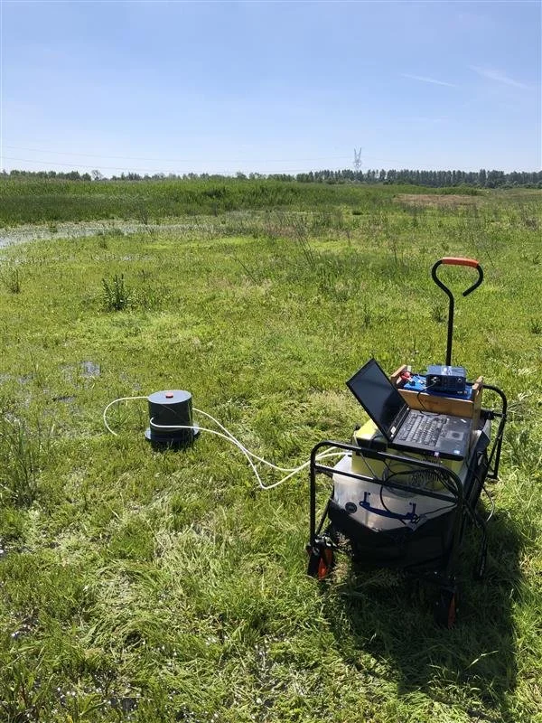
Our role is to investigate the climatic benefits derived from this nature-based solution. We have been measuring emissions of the three most important greenhouse gases (CO₂, CH₄, and N₂O) from 2022 to 2024 in adjacent salt marsh habitats to determine how the greenhouse gas budget of the area will develop over time with an emphasis of different management styles and biodiversity. Additionally, we have measured the existing carbon storages in the sediment- and plant fractions to help assess dynamics and potentials for carbon storage in these types of nature-based solutions.
The case study of Seden strand also acts as a demonstrator site as part of the Reconect Project within the European Unions Horizon 2020 programme. Odense Municipality is the key actor of the project and the main contact.